- The Disappearing and Forgotten SettlementBay St. George has a unique history; a well-profiled area, but very little is known about people and settlements after John Cabot discovered the New-Found-Land in 1497. Since then hundreds of communities were recognized and brought to history's attention, with one discovery at L’Anse aux Meadows in the northern part of Newfoundland, a foundation dating back to the Vikings in 1000. There's not much information on older communities that existed in the Western parts or in Bay St. George area and no records of the first smaller settlements in those area. Also very little was written about the country people that was scattered and lived throughout the banks of the rivers, along trails, and mounds of the interior of the bay St.Georges area.
To our knowledge the past three centuries, history on settlements has been spoken of and written documentaries of three main settlements in general of the St.George’s district.
The first well known, Sandy Point or Flat Island, was once the main center of the whole West Coast of Newfoundland. It was recognized as a settlement in the 1600,1700,1800,1900 hundreds. In 1822 there lived 102 people and occupying 400 to 600 hundred livers at the height of it’s history.In 1972 the last three people, the Swyers family left the Point, leaving it naked of human beings. Before the 1500 hundreds very little is known of people wandered this whole area, but never stayed, only for a short length of time.
The second settlement, on the south side of Sandy Point, St.George’s, now with many different nationalities of people living seasonally and permanently since the middle of the 1500 hundreds, in 1822 population 97, population 1400 hundreds in 2005.
After the railroad went through in Western Newfoundland in 1892, St. Georges was the main center off the West coast of Newfoundland.
Then places like Journois, Flat Bay, Middle Brook, Berry’s Brook and Fischells started to develop in short –term and long- term settlements, but still maintaining seasonal homes in country areas. To the North, Barchois Brook, Mattis Point, Stephenville Crossing were smaller and were well known settlements, some still exist.
The third, now its main town: Stephensville or Indian Head, with American influence in 1940’s- 1960’s, was Harmon Air Force Base until 1966. Once known as the Acadian Village, founded in 1844, because of poverty and strife existed in Nova Scotia and ongoing conflict between the English and French, this area offered fishing ground and farmland, and so people migrated to this location. Now in 2005, its population 8,900 and declining each year.
Only mentioning the three larger settlements/towns in the 1600,1700,1800,1900,2000 centuries and smaller communities that started full time residences in Bay St.George after the train pushed through western Newfoundland in 1898, one must know that before time in history very little was written about this area.
I will then take you to some unknown settlements, unwritten about, along Flat Bay Brook, that maintained liveries sinse the nomadic movement of the people in Bay St. George and throughout the island. I will only use one river because I’m most familiar with in my life span, and it would take thirty years to write on all the settlements of all the rivers in the whole bay St. Georges area.
The people are still here, 2005, surviving on a social dependency with government agencies and not a lot of industrial development unfolding fore future generations.
In this chapter I’ll focus on settlements that lead to those area of recession and their survival. Settlement meaning: one or two families up to five and living seasonal/nomadic, depending on the economic and fir trade changes that occurred and movement of the Indian/European people across the Island and elsewhere.
People’s survival, here with no roads or trains, governments only slowly developed in the late 18th century, and then eventually came to the Western Newfoundland before this people had their own government.
In light of the many different places that people lived and no written account of years of nomadic movement in the whole off the bay. I’ll use, Flat Bay Brook, and three small settlements in general but will also mention places in between those three main settlements witch are: the Path End, Shack Town, Helch Gulch that very little was know in history. That area still occupies Mi’kmaq settlements part-time and full-time residents down through the centuries and even yet today.
First then I must start with people in general, that had the ambition to undertake strives in life, that meant hardships; starvation, sickness, wars, genocide, and tragic deaths.
To understand settlement two hundred years ago, you have to understand survival off our natural earth, of its vegetation, animals, fish, land; the cycle of mankind and survival as we know it, that will be mentioned in all chapters throughout the book.
But in general I’ll set a short summery of, early exploreres, the land ownership, (Geography See Chapter VII) and a briefing on animals, plants, to attract, and lay an overall lookout of this part of the rock, that people came and settlements in many area throughout Bay St. George and nothing was known of this country only a few voyagers wrote notes and keep their righting for history.A brief summery of early explorers to Bay St. George.
The first Occupancy of settlement was yet uncertain, especially in the Bay St.George. The Basques whalers, Jersey freshmen, Portuguese fisherman, frequented
some of the main area of the west coast of Newfoundland in the very early years. Humans frequented the shores on expeditions, only on extreme conditions did they stay for any length of time, some remained to take advantage of natural resources then stayed to develop short-term settlement.
History has noted that French set up the first settlement in some area along shorelines. Mi’kmaq that already had settlements in the interior/shores of Western Newfoundland were allies with French. They lived together and assimilated customs and a new model of living emerged in some part of Bay St. George. That began our existences of fir trade expedition witch came about.
The Beothic, Eskimo Mi’kmaq at times and in latter history ingratiate into that stile of trade and life, except the Beothic that had very little contact with European only on some area of the east coast.
The Scottish, English, Irish, and Americans established long-term towns and many more, mainly in small areas in Bay St.George, Sandy Point, St George’s and Stephenville, known to be the later years of the history of Bay St.Georges.
Even those settlements then were economically based, very little was written when these first settlers arrived and who lived where. For one reason they grouped in very small one or two families in different area, survival was nomadic movement and was important but very few people could write, only after priest visited area were there any documentation on settlements in Bay St.George, nothing was written of the inland communities. Only but a few voyagers who wrote, documented their visits in history of NL.
The Beothic and Mi’kmaq, Inuit never wrote manuscripts on social or economic development and structure of their government, that was unique but not the same as First Nations people of today. Many changes in structural life stile existed before contact, and Short-term settlement were established long before any country entered and then stayed in the bay St. Georges area.
Land and ownershipIndian families accrued/worked hundred of areas of land all throughout Western Newfoundland, not claiming one house block for their great great grandchildren. Only after people of modern day living arrival did people claim land. Very little education on customs of European lease/grants did Indians know, in the unnatural land rights of the Island in general land was belonged to everyone. The people were interested in survival not land rights or ownership, the people only used what they needed to live on, trapping and hunting. Their spirit fought for Freedom we have today, their memories still lay on the land that lead trails for generations to come. The British lay claim in 1850 to Newfoundland and named some colonies in Newfoundland, after that ownership came into play.
Only in the 1970’s Indians started to develop another stile of government in Newfoundland and Labrador, (Federation of Newfoundland Indians), Mi’kmaq and Inuit in local band’s, that already existed but not recognized by any government or any other part of society, especially Flat Bay Brook, the land/people off the forgotten, people call it. Only Conne River laid claim for reserve lands for Indians.
But my subject in this book is not focused on government particles, merely where the people settled and lived, with the land, of the land, and relations to the land, and lay heed in those cycle of change/progress of mankind.
Animals
The main animals, fish, larger trees, and smaller plants that were assessable to people that wandered in consent turmoil to survive, in years before the Trains, Trans Canada Highway was even though of in Western Newfoundland, I don’t think the people were aware that this Island was like a Paradise with an abundance of natural nourishment to survive.
BearThis animal wandered the whole of NL., was a strong survivor, ate salmon, bees, berries and so did the people, indulged what the bear ate, then human survived of this huge natures delinquent child, and sustained life themselves.
CaribouEndless herds stamped their paws in migration thousands of years before any contact with human’s. After trains and roads, thousands were slaughtered with a uncertain want, interfered with the cycle of nature, damaged the survival of this life preserve animal only now returning to it’s natural home near their trails of life, from the open barrens and grasses in the southwestern lands of the west coast of New found land. I’ve been in many frightful places on the island and where humans are not encamped the Caribou remain.Beaver
On the waters ways hunted/trapped in this VAL managed only to save from extinction this fierce animal that fed and clothed hundreds of people all over the globe. Of it’s kind there are none like him. His survival was dependent upon Indian people, only to alter their trap lines and today all the streams in Bay St.George is home for generations to come for our children to admire.
Codfish
When we speak of cod, we talk about the oceans of the world and the impact it has on other nations/species because of the food chain besides Newfoundland. To the Beothou/Mi’kmaq no great impapct on survival other than other nations settling along shorelines that they occupied during summer actives. The whole of NL. Was impacted by the commodities of such a fish. It will take 400 years to reset natural stocks of this spices.
Salmon
One of the main fish, and at the Main Gut, for human diet exposed to every brook, river, stream, and lake of Western Newfoundland, struggling in its natural habitat. It still remains uncertain of it’s extinction.
A small salmon trail of pools from the dam pool to Helch Gulch.This will give you an out look on the many salmon runs just on one area, one brook. For example: at the T.C.H there is a pool on both sides of the bridge, then travelling east next pool you have the Dam pool, then farm pool, Peter Stride's run, Crocket Pine Pool, Ralph Muise Run, Manewage Turn Pool, Three Brooks Run, Strawberry Pool, Turn Pool, John Muise Run, Helch Gulch Pool, only enchaining the larger pools in this area of Flat Bay Brook.
EelsEels are still uncountable in our natural, rivers, brooks, ponds, lakes, and oceans, still fished in the whole of the bay area.
Ducks and Geese
Water fowl, natural eggs, like foxes, were reared by the people and had existed year round if necessary. These still cover a massive portions of our, ponds, rivers and lakes.
Seal
Seals with it rich fiber was a constant attractant to the new world. For the people that used it for food, heat, clothing,etc;, sometimes that was all there was to live on. After centuries again nature took its toll and siblings were reminders of the darkest days of this country.
Pine
The pine with its greenest shades called upon to shelter the under growth of our fresh fruit bearing threes, vakued by mankind for their own shelter.Birch
The endless struggle of rind for Wigwam ended when the fir and spruce and birch vanished, to drives down rivers. Hundred of companies almost turned the rock into a desert. Now a day a new growth appears again beneath the fruit bearing threes.
Fruit
In Flat Bay Brook valley the natural fruit was of abundances.... strawberries, raspberry, blueberry, and chokecherries, bake apples, apple and plum trees cranberries, squash, pears, to preserve in winter. I could only imagine the animal/human encounters, indulging in feast along natural trails that lead to their health and welfare.“Steal Mountain”Settlement on Flat Bay Brook, (three settlements)Today there’s one settlement that has no name. It is beneath the great Steel Mountain , (natural mound area for settlement). It is an historic site in our forgotten history, four kl. from St.George’s. One mile from the special place for people in early days, Path End, another settlement not written about. Only Mi’kmaq people live here for any length of time. They are the descendents of the forerunners of change. Muise’s, Jesso, made up of two or three families. A country chain of trails leads to this forgotten site and along the riverbanks, then to the Southwestern country.
Some times there were as many as thirty people living here. The Hayses built lodge cabins for workers on the South side of the river directly down from the Path End. At the Path End people lived all their life and were not in need for any out side assistance to survive. One woman, only upon death, did she leave her home at the Path End. She told me stories of the richness of the places beyond Ball Mountain, southeast of the area and not minerals, the path to John Mary Pond. My close relations lived a long and contented life there.
In ancient times it is where the trails end, from the sea to the country. Cormack crossed this area of the brook before proceeding to St. George’s.
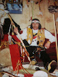
Women in those days were respected and took care of all life in their clan, plant life, animal life and human life. When I was 10 years old I’d wandered there, looked like a paradise that people only read about in books and dreamed about. The beautiful apple, plum, chokecherries trees and three areas of a vegetable garden just down from the settlement.
My Aunt Jessie, a Samaras for all her long life , now 89 in 2005, used to stay at the Path End and portage an axe with loads of wood to bring out to their summer homes .Another forgotten Mi’maq settlement is Dog Town/Steel Mountain Road, St.George’s. In memory she said "That’s the good days." There are still two families living at the Path End.
Coal brook
On the South –West of the Path End, farm land narrows Little Level (Plateau, a brook running direct South-East into the country leading to Old Country Pond. Many of the people that forged their trapping skills as another settlement of Muddy Hole to the Western side of its mouth. Today there are many cottages l on this flat flood land and a road entering off the T. C. H. East of Flat Bay Junction.Sheep Brook (on the North side) is a small river that crosses one old country path near those forgotten communities. There’s no community development, one artisan well, only dug in the 1980’s, and no children went to school. Today two children are in school, bused to St.George’s. There was no shop and so on in 2005. Another small area has been se tup all along Flat Bay Valley. I lived here for six years, and back/forth all my life. I always had fresh fruit from my garden, corn, tomatoes in greenhouses set up. I sold them to Art Neal’s wife to make relish, but all my life portaged this great valley. You could somewhat live off the land in them days. But there are changes in life and for work I had to move on. But the place remained the same, almost exiled from the rest of society. Mi’kmaq’s never named settlements of this sort, they always had natural markings on places they lived Steel Mountain, for example, an historic site.Manewage Valley or Skull ValleyThe next Mountain on the south side, in a SE. Direction of Flat Bay Brook St. Mountain or Caron Mountain, there’s a mountain of many legends. It’s a place that marks the center of Indian civilization, Mandewage. For Mi’kmaq it marks their traditional lands. Legends say it was called Skull Hill, and for a good reason because of the way they buried their dead Here is an example: dig a round hole, put the body in a passion like in your mother's womb, with your secret objects between your stomach and knees. Indians buried their remains four feet beneath mother earth,, then a ceremony was conducted and a chant was sang. Only in memory would they return to that area. A special area was set up for different tribal clan and respect which was the base element in Indian spiritually, that area was honoured for eternal life. To me this is no a Legend, I all ways travelled those sacred and special places of the Indian people and I pray that Mi’mack people will remain along those’s area of Flat Bay Brook.
Oliver’s Island lay at the foot. At one time there were apple and plum trees, tame geese, ducks and jersey cow existed). Across the river, from this historic site in timeis where people lived... Manewagi, meaning "Indian Territory". My brother Terrance Morgan Muise lives across the river and live here part time, playing his Mi’kmaq drum and chanting/praying for peace in the world, of this forgotten Mountain.Another settlement three kl. Up river on the north side of Flat Bay Brook is a place called, Shack Town. Five families stayed here during winter months. At times there up to eighteen strong in 1951 .It was approximately seven miles southeast of St.George’s town. There was a trail leading to Bear Pond in the Northerly direction with one camp in this area. A trapping site for beaver, the trail leads to St.George’s in early years, and a good trail at that, elders often told me. This trail was there forever. Old Bill ,the mountain man he was called, told me this trail was not the one Cormack and Gabriel came through. Yes, every countryman told me of different trails Gabriel took in their last hard stage of his journey, It’s like my knowing this country like the back of my hand. Its not likely Cormack passed Bear Pond Lead, not the fastest and easiest Path to Seal Rocks from Old Country Pond. I forged this trail many times with a quarter of meat on my back, with straps made from the animal hide. Those days are gone! People lived here long before my time and still go to their cabins yet today.
Across from Shack Town on the south side of Flat Bay Brook there were huts on both sides of three brooks. Up Three Brooks there is a place called Killers Canyon. Jim Blanchard said to me that there were huts there before his time, and he was 84 in 1992. In earlier years, a company, Ilet Timber, had a dam built across three brooks and one over Three Brook Falls, and at the Steady. They flooded those areas when making a drive of logs and pulp wood down stream. The lands here were fertile for planting. Much land was cleared and survival there was excellent. Settlements for generations, before the present cottages of today, my brother Len and I fished here for years, walking from Dogs Town to Three Brooks. An excellent salmon pool lie at the bottom of the Steady, called three Brooks Steady, a place I’ll never forget after losing my, BOAT MYTRLE.
Strawberry Island has medicine at it’s best. This place is the garden of fruit. People lived here all year..... Joseph Muise, an unknown poet of his time, and his brothers. There are five camps still remain in this town now still called Strawberry. It’s the main salmon pool in the whole of Flat Bay Brook and a fresh water creek north in the hillside running crystal cool to the settlement.
South across the river from Strawberry Island there is a pond called Blanchard’s It has one liver part time, a well know trapper staying to cure pelts for trade. I visited this site but it’s baron, only memories remain and beaver to remind me of those days of my brother Ronald trapping, when trapping was fading like the trail of our early family life, that we spent in this country a long, long time.Calvary HillThe Third Mountain well known to the Mi’mack was called Calvary Hill, an ancient mound of my people and the settlement called Helch Gulch. Two or three families lived here,sometimes year around, the Muise Clan. They trapped, fished, hunted, farmed (meaning preserve for winter), and lived directly, simply, of the land. Near the country plenty of water fowl, ducks, geese, partridge. They would rear their own animals, grandfather said "And it’s one hell of a place. You could survive here to death". In Mi’mack death was a natural form of living. Two livers still live year around at Helch Gulch, my sister being one.
Across Helch Gulch, south on the opposite side of the river, Jack Webb’s settlement, two families lived here year around . I know this area well, and know the grand children of there people. After the Railway went through they abdicated this area. The pond is the deepest pond off all the ponds in the whole area. I have pictures of the fields that were left many years later.
Across Jack Webb’s pond, on the north side of Flat Bay Brook, I’ll never forget, I found high grade gol, in 1994. I had gold fever for three years. I traversed the rivers and brooks of the whole Bay St. George, but not too many places could be of more beauty than Jack Webb’s Pond area.
Another settlement is Birnt Point, four and half KL. East of Webb’s pond. Up to three families lived here part time, still one camp remain It is a, good area with easy access to the country There are small camps in among the hills and ridges of this area also. My brother Len and I sleep in one for a night (A place I called little Minnie Meadow), prospecting the area for minerals. We got some chert to make arrow heads. It was a good lookout and one could see four miles down the river.Now there is a brook running North East called Look Out Brook and a settlement and a pond 16 miles from St.George’s called Fox Pond. Fox ranches were established there. People portaged this site long before lookout power plant established. To the east of this pond is a place Mi’kmaq called the graveyard, and many herds of caribou crossed this area. It was a good look out for people. People would trap and rear foxes for trade with Europeans and also clothing, They wandered and lived in this area for centuries. There’s still one levier living here year round. (Gordon Muise).
Then to Dennis Pond, Long Pond..... North of Long Pond there are three ponds called Jack Joe's Pond, Cross Pond, Green Gulch Pond under Bear hill, altitude app: 3000 feet above sea level and beyond. There was no end to camp sites from here to Conne River and the inland waters of South-Western Newfoundland. (I know.... I’ve been there, for the last 40 years of my life, camped in some of those area).After the power plant at Look Out Brook started, economic structure at it’s best changed the whole area of Flat Bay Brook, Valley. There are still 87 summer cottages alongside this magnify brook.The further the settlements went inland, the father you can go back in history. Mi’kmaq wandered those natural resources for many, many years. To the readers of this book: I used this area from the Path End, to Fox Pond, along Flat Bay Brook, places that I’m more familiar with. If I had to do all the brooks in the Bay St.George area it would take all my life to visit those sites .
No comments:
Post a Comment